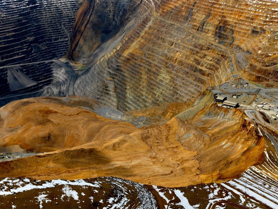
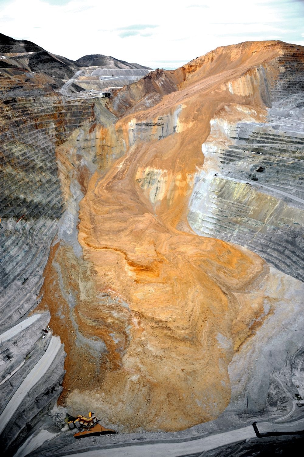
On April 10, 2013, a gigantic chunk of earth and rocks gave away and crashed into the humongous pit created by copper mining at the Bingham Canyon Mine in Utah, the United States. Approximately 65 to 70 million cubic meters of debris thundered down the walls of the mine reaching speeds up to 100 miles per hour. The event was so large that it shook the earth and the tremors were picked up by seismic sensors designed to record earthquakes. The intensity recorded by the instruments measured 2.5 in Richter Scale. In other words, the landslide felt like a 2.5 quake.
The incident was the largest non-volcanic landslide in the modern history of North America, and it occurred in the largest man-made excavation in the world.

Photo credit: unknown
Bingham Canyon has been producing copper since 1906, and supplies 25% of all copper used in the United States. More than a century of mining activity has resulted in a massive crater that is 970 meters deep and 4 km wide. The hole is such a spectacle that it was designated a National Historic Landmark in 1966.
As the mine grew and the hole became deeper and wider, mine operators began to question the stability of the slopes of the pit. So they installed the latest in surveillance technology that included sensors such as automated geodetic networks, in situ extensometers, and ground-based radar interferometry. Thanks to these monitoring systems as well as the seismic network operated by the University of Utah Seismograph Stations in the Utah region, the Bingham Canyon mine landslide is one of the best recorded in history.
In early 2013, mine operators picked up signs of increasing instability on the northeastern wall of the Bingham Canyon mine. In the morning of the landslide the movement began so strong that they immediately evacuated the area. The first landslide occurred seven hours later, followed by another one 1.5 hour later. Each avalanche lasted 90 seconds. Altogether, some 65 million cubic meters of debris were deposited, enough to cover New York City’s Central Park with 20 meter of debris.
Interestingly, the landslide also triggered sixteen smaller earthquakes —real quakes— making the landslide the first in history to have triggered quakes and not the other way around.
Although loss of equipment was inevitable, because of the early warning system, no loss of lives occurred.
Related: Frank Slide: Canada’s Deadliest Rockslide Now a Tourist Attraction

Photo credit: fox13now.com

Photo credit: fox13now.com

Photo credit: fox13now.com

Photo credit: fox13now.com

Photo credit: fox13now.com

Photo credit: umfablog.wordpress.com

Photo credit: Miaomiao WANG/Flickr

Photo credit: Miaomiao WANG/Flickr

Photo credit: Doc Searls/Flickr

Photo credit: Doc Searls/Flickr
Sources: GSA Today / Wikipedia / University of Utah
Subscribe to our Newsletter and get articles like this delieverd straight to your inbox
The incident was the largest non-volcanic landslide in the modern history of North America, and it occurred in the largest man-made excavation in the world.

Photo credit: unknown
Bingham Canyon has been producing copper since 1906, and supplies 25% of all copper used in the United States. More than a century of mining activity has resulted in a massive crater that is 970 meters deep and 4 km wide. The hole is such a spectacle that it was designated a National Historic Landmark in 1966.
As the mine grew and the hole became deeper and wider, mine operators began to question the stability of the slopes of the pit. So they installed the latest in surveillance technology that included sensors such as automated geodetic networks, in situ extensometers, and ground-based radar interferometry. Thanks to these monitoring systems as well as the seismic network operated by the University of Utah Seismograph Stations in the Utah region, the Bingham Canyon mine landslide is one of the best recorded in history.
In early 2013, mine operators picked up signs of increasing instability on the northeastern wall of the Bingham Canyon mine. In the morning of the landslide the movement began so strong that they immediately evacuated the area. The first landslide occurred seven hours later, followed by another one 1.5 hour later. Each avalanche lasted 90 seconds. Altogether, some 65 million cubic meters of debris were deposited, enough to cover New York City’s Central Park with 20 meter of debris.
Interestingly, the landslide also triggered sixteen smaller earthquakes —real quakes— making the landslide the first in history to have triggered quakes and not the other way around.
Although loss of equipment was inevitable, because of the early warning system, no loss of lives occurred.
Related: Frank Slide: Canada’s Deadliest Rockslide Now a Tourist Attraction

Photo credit: fox13now.com

Photo credit: fox13now.com

Photo credit: fox13now.com

Photo credit: fox13now.com

Photo credit: fox13now.com

Photo credit: umfablog.wordpress.com

Photo credit: Miaomiao WANG/Flickr

Photo credit: Miaomiao WANG/Flickr

Photo credit: Doc Searls/Flickr

Photo credit: Doc Searls/Flickr
Sources: GSA Today / Wikipedia / University of Utah
Subscribe to our Newsletter and get articles like this delieverd straight to your inbox
Bingham Canyon Mine Landslide
4/
5
Oleh
Chandu Numerology


